Fishing Creek Community Trail
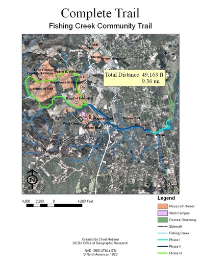
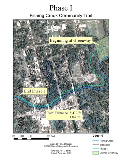
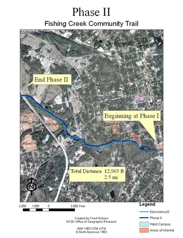
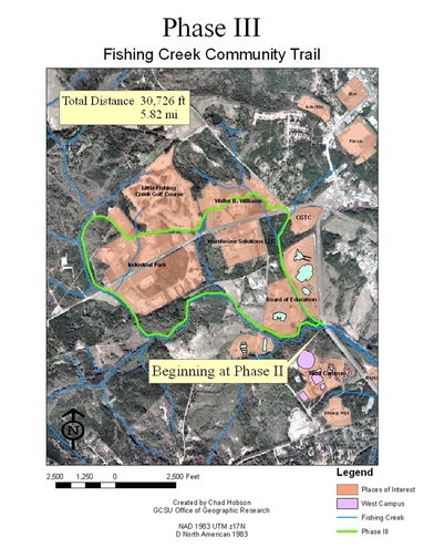
Following grant funding from the HKHC project, the next phase was to plan the route of the trail. Between walking the route with a GPS, digitizing, and analyzing existing data a trail was laid out. The following images are a collecting of map documents that were used in preplanning. Extensive terrain modeling was then done using a total station to create topographic maps for the engineers to use to actually design the trail.
|